

Riders stopped in their tracks by Inverloch's missing link
Apparently, there’s been some argy-bargy between the Bass Coast Shire Council and Vicroads over the location and design of a safe crossing of Toorak Road for the Inverloch to Wonthaggi shared pathway.

OVER the summer holidays, residents of Ovata Place in Inverloch regularly fielded the same question from holidaymakers and locals alike.
“How do you get to Wonthaggi from here?”
Mounted on bikes, usually in twos and sometimes threes or more, with packs on their backs, they’d arrived at what they thought was the start of the 14km Inverloch to Wonthaggi Trail.
Having ridden up Goroke Street from the Inverloch Surf Lifesaving Club on a newly minted path, over the pedestrian bridge (past ‘Snake’ park) and into Tea Tree Cresent and finally Ovata Place, they were greeted with a signpost saying “Wonthaggi 13km”.
But oh dear, with no way to cross busy Toorak Road, on a bind bend, to meet up with the pathway, initially along Drowleys Road, the way forward was by no means clear.
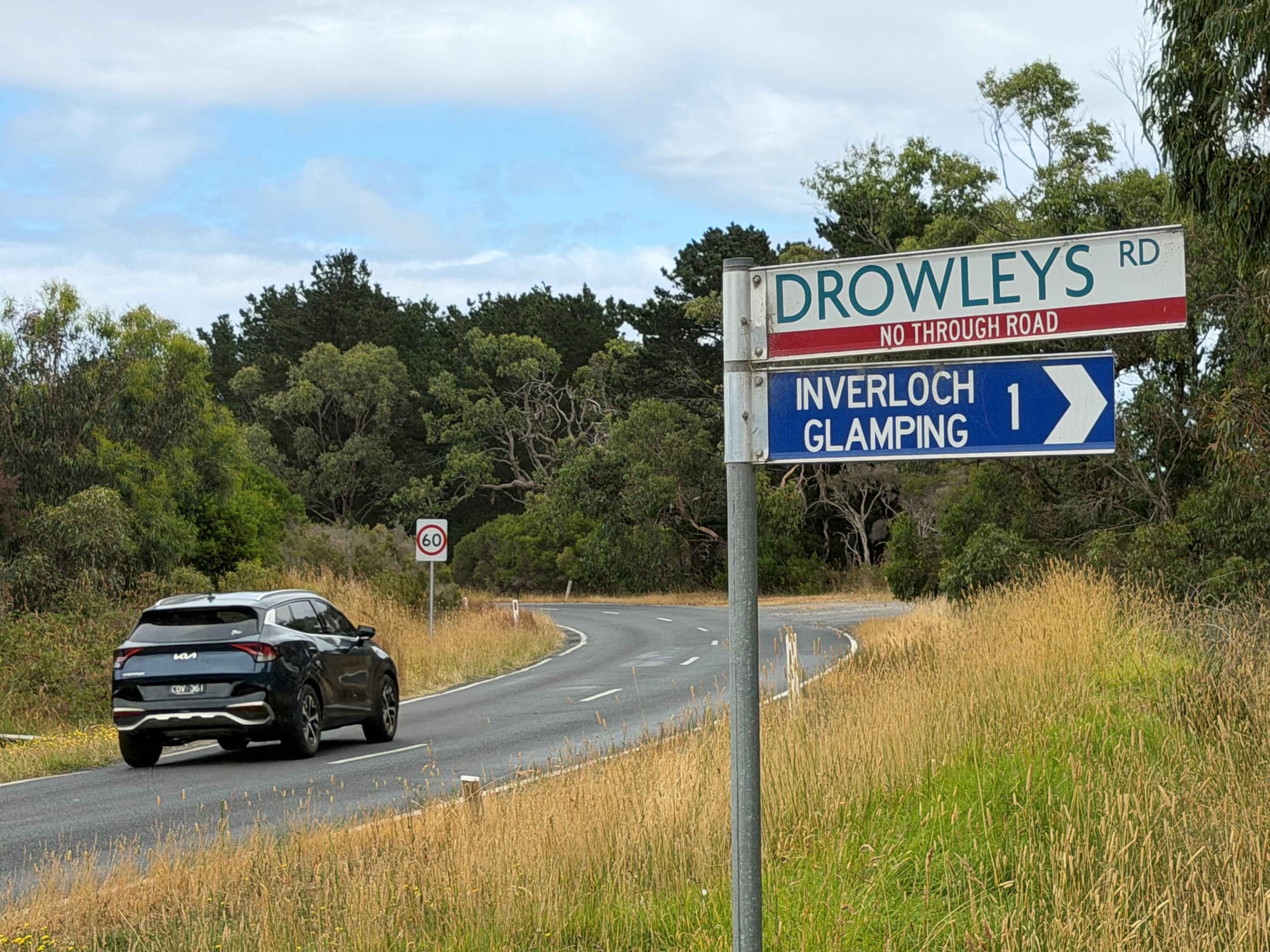
Apparently, there’s been some argy-bargy with Vicroads about the location and design of a safe crossing of Toorak Road and the council still hasn’t locked in an approved plan.
The Sentinel-Times asked about the timing for the crossing and whether the “pedestrian refuge and road widening” proposed would be covered within the $7.7 million scope of works.
“Yes, the cost of the crossing is included and is currently in the final stages of approval,” said the council this week.
“Construction of the exciting and much-anticipated Inverloch to Wonthaggi Trail is progressing well, with no expected delays at this stage.”
Council listed the completion date as mid-year 2026.
Their January update on works was as follows:
“Construction has progressed well with all areas of gravel path expected to be complete by the end of March.
“Boardwalk construction is underway on all the boardwalks for the trail, with several completed in their entirety.
“The initial planting program has been completed and is now being monitored and maintained by Bass Coast Landcare.
“Signage installation has progressed along much of the path.”
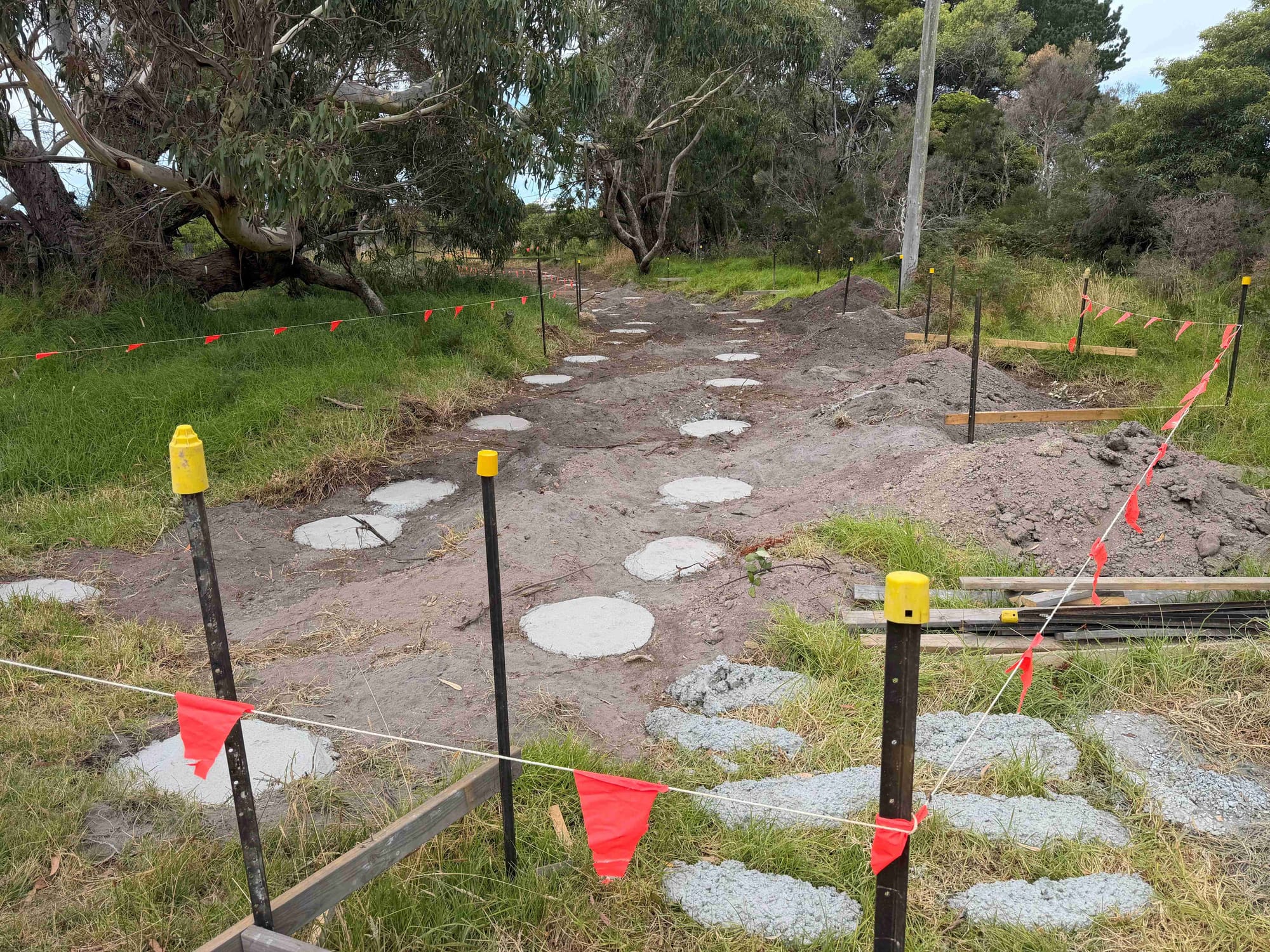
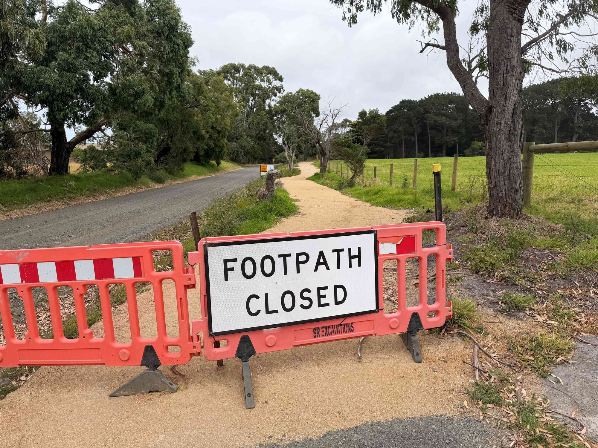
While bike riders have been out exploring the trail, it is not yet open and several sections remain impassible.
The idea of the path is that it will connect two of Bass Coast’s key residential and commercial towns, Inverloch and Wonthaggi, via a new off-road shared path which council says will provide greater active recreation and commuter links, “playing a critical role in the health and wellbeing of the community”.
“A 14km inland route, this pathway features attractions along the way such as wetlands and native vegetation which provide habitat for wildlife and glimpses of the Bass Coast. This pathway enhances the current bio-link corridor which connects pockets of native vegetation. As part of this project, we will be undertaking revegetation works in existing cleared areas.
“This pathway connects to a much greater off-road shared pathway link extending from Inverloch to Cowes and, in future, will form part of the Gippsland Odyssey, a 700km path linking Gippsland. Furthermore, the network of trails will also link to the Mornington Peninsula with a quick trip on the Phillip Island to Stony Point ferry.”
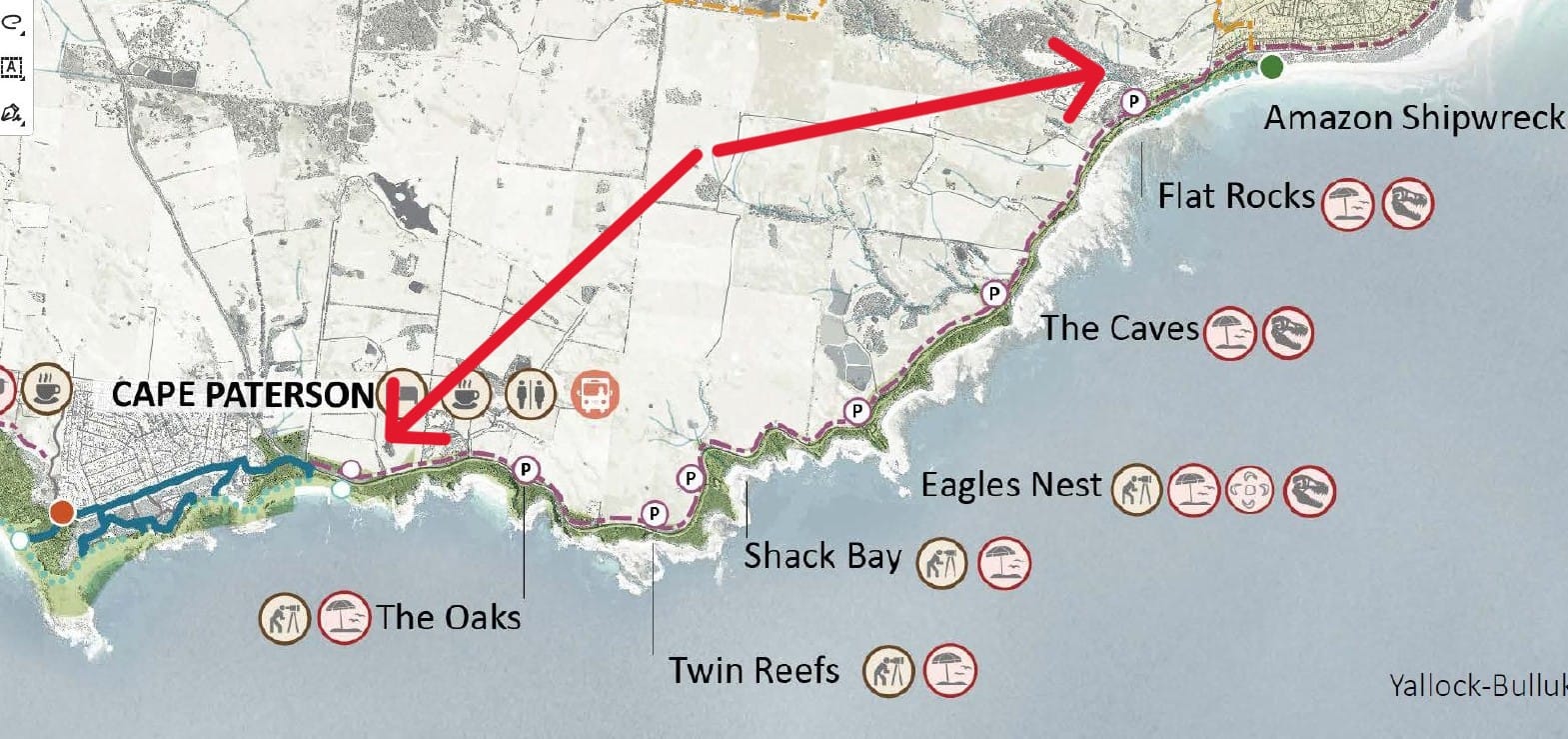
It does not preclude the construction of a coastal pathway between Inverloch and Cape Paterson.
“Council is fully supportive of the Yallock-Bulluk Marine and Coastal Park plan which refers to a proposed new shared use trail along the coast between Cape Paterson and Inverloch.”
The Wonthaggi to Inverloch pathway is estimated to cost $7.7million. Council has secured a grant from the Growing Suburbs Fund of $3 million. Council will fund the remaining $4.7 million from allocated funds as highlighted in Council's Long Term Financial Plan.


