

How climate fears are starting to hit home
Special Report By Michael Giles YOU’VE got to give credit to the Bass Coast Shire Council for the way the Pioneer Bay special charge scheme has turned out. Homes in the little Western Port settlement are now framed by a tidy and orderly system of...

Special Report By Michael Giles
YOU’VE got to give credit to the Bass Coast Shire Council for the way the Pioneer Bay special charge scheme has turned out.
Homes in the little Western Port settlement are now framed by a tidy and orderly system of kerb and channelling, clean bitumen pavement has eliminated the dust and wide concrete driveways have engendered a new sense of pride for residents.
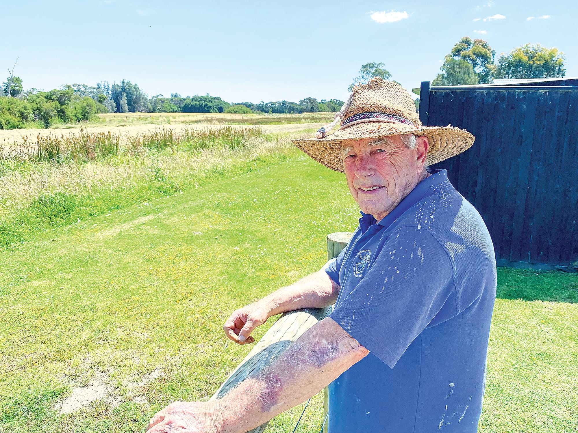
Even Clive Renshaw, a consistent critic of the Bass Coast Council over the years, has dipped his lid.
“You should have seen the stormwater that came out of the new outfall drain when we had all that rain, it was like Niagara Falls,” said Clive this week.
But, oh dear, you can’t charge people between $15,000 and $30,000 to get the streets and drainage done, not to mention $6000 for their driveways, and then turn around and stop the owners of two, possibly three residentially-zoned blocks of land in the town from building a house.
That’s what is happening there right now and local councillor, Rochelle Halstead, has raised her concerns, putting the ball squarely back in the court of Melbourne Water, which she says has tightened its response to residential and commercial building applications on Land Subject to Inundation Overlay (LSIO) sites.
“They’ve objected to applications for houses on two blocks of land in the middle of the residential area (Pioneer Bay), and the brewery proposal at Rhyll has been caught up in this as well,” said Cr Halstead.
“But it’s not just Pioneer Bay. There would be hundreds of blocks across the shire that are subject to an inundation overlay.
“A lot of people have a lot of money tied up in these blocks.
“But it’s not just Bass Coast, it’s the same right across Victoria. It’s a huge issue, millions, billions of dollars involved. The State Government needs to step in.”
Cr Halstead said Melbourne Water was responding to reports, principally about the risk posed by sea-level rise, not only from climate change but also from storm surge combined with riverine flooding and was changing the rules ahead of State Government legislation.
“The council can’t be overriding these objections from Melbourne Water, it’s really a State Government issue,” she said.
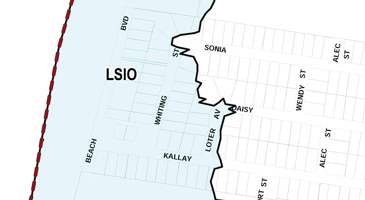
It’s all about the Land Subject to Inundation Overlay (LSIO) which covers the lower third of Pioneer Bay, from Beach Boulevard, partway up Kallay Drive to Loter Avenue, and a new, stricter interpretation by Melbourne Water is impacting those who want to build, either new homes or extensions, in the area.
But hundreds of settlements across Victoria, especially in low-lying coastal areas, are similarly impacted by LSIO restrictions, expected to come into sharp focus as the planning response to climate change is ramped up.
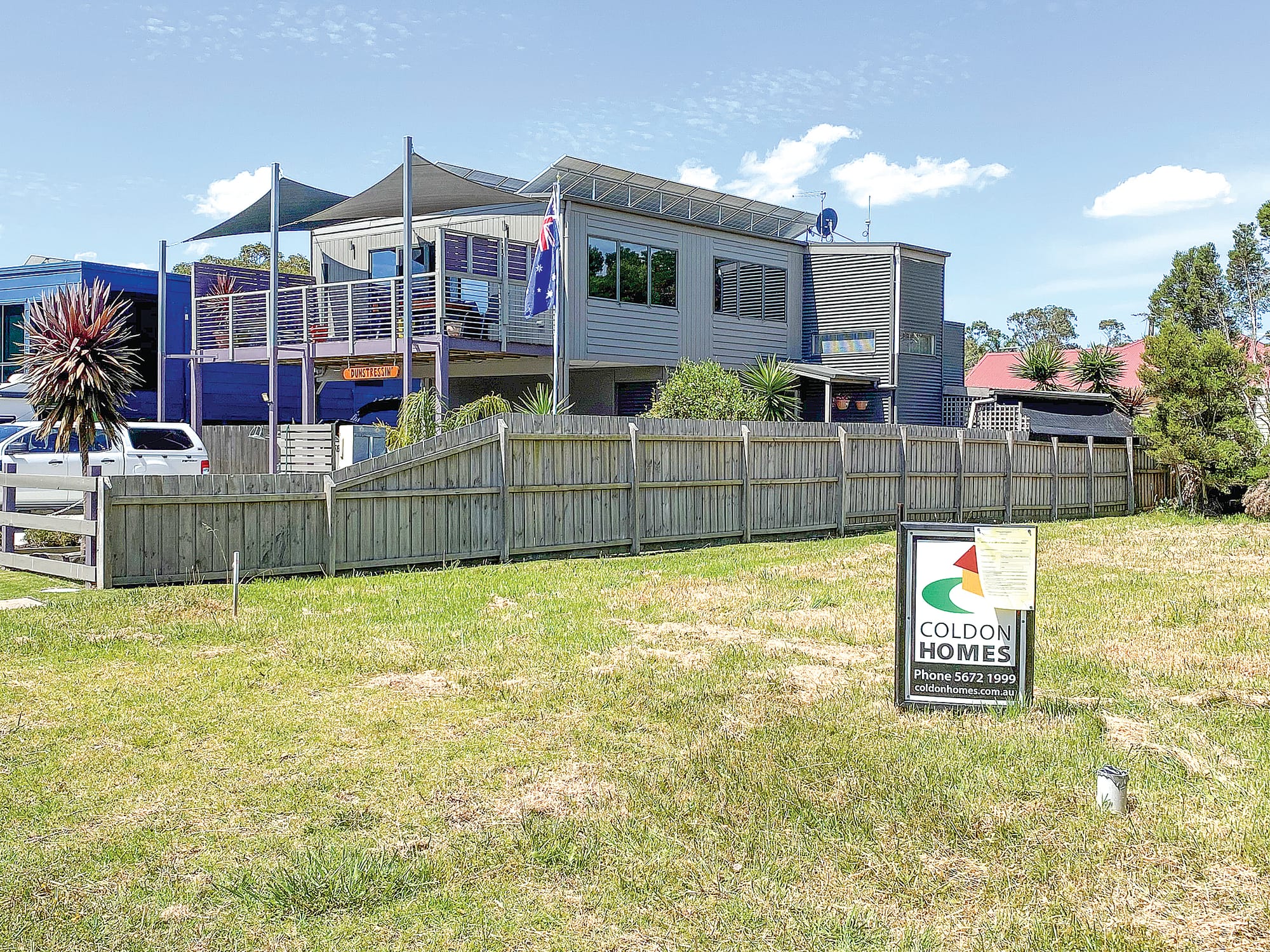
It’s already stopped two new homes from being built, with another planned, two in Whiting Street and another, with the owner ready to go with a new Coldon Homes residence, in Beach Boulevard.
There’s already a sign posted on the block advising neighbours.
Particularly galling for the owner of one of the Whiting Street blocks is that they purchased the site in May this year, for $230,000, only to find out now that Melbourne Water has toughened its stance.
It’s tragic.
For the owners of an ideally located Beach Boulevard block, who have two handsome-looking homes on either side, they’re unable to build theirs in the middle.
The shire council’s response to Melbourne Water has been to simply issue ‘Notices of Refusal’ but surely, having charged them for a street scheme, completed only a few months ago, they could be offering the ratepayers more help.
What if the houses were raised ‘Queenslander’ style or if there was better drainage?
Here’s how refusal was advised in the council minutes:
* November 2022 BCSC Meeting: “PERMITS REFUSED: 210449: Development of land for a dwelling in the BMO and LSIO located at 12 Whiting Street, Pioneer Bay.”
* December 2022 BCSC Meeting: “PERMITS REFUSED: 210307: Development of land for a dwelling in excess of 7m in the DDO1, BMO2 and LSIO located at 11 Beach Boulevard, Pioneer Bay.”
Meanwhile at the same November council meeting, the shire advised that “extension and alterations to a dwelling in the Land Subject to Inundation Overlay (LSIO) located in Lohr Avenue, Inverloch” would be allowed.
Other new houses were allowed within the LSIO zone in Lohr Avenue in October.
Also, in Silverleaves on Phillip Island, the council has allowed several homes to go ahead in recent months.
A multi-million dollar, 46-lot residential subdivision in Dalyston, partly involving LSIO land, was approved by Council in April this year, involving elaborate drainage and wetland plans to combat any flooding or inundation issues.
So, where’s the consistency?
Neighbours in Pioneer Bay acknowledge problems with the blocks in question but claim it’s as much a drainage issue as an inundation risk.
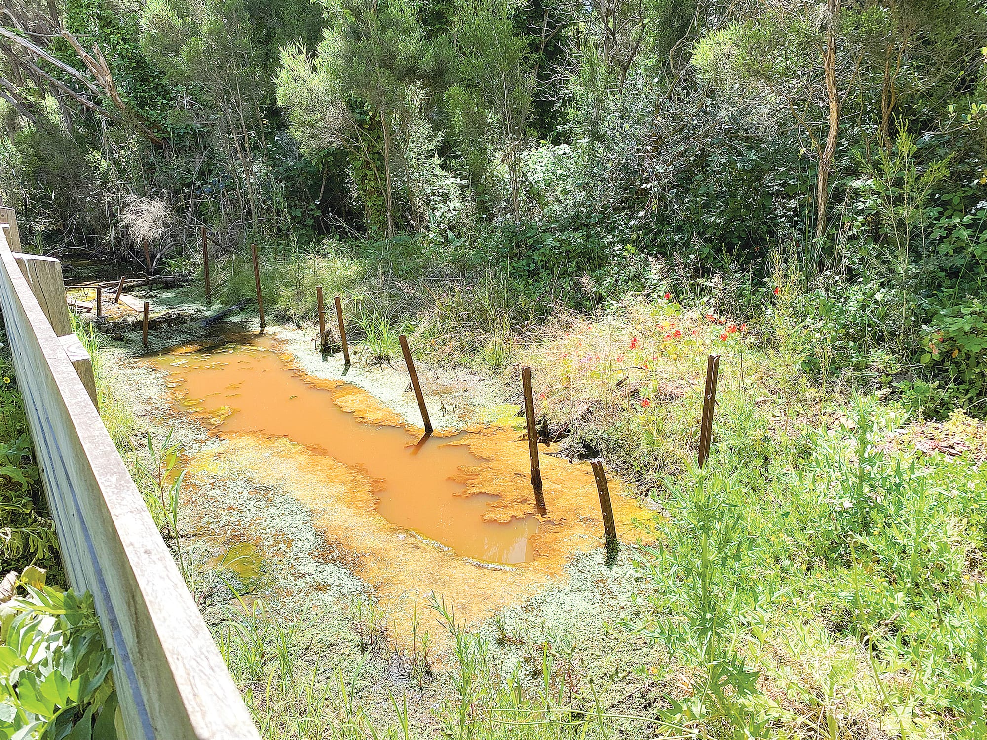
Pat Van, treasurer of the Pioneer Bay Progress Association, says Melbourne Water should start by clearing the reeds and vegetation blocking ‘Flat Bottom Creek’, which runs beside the town, and is supposed to allow drainage of stormwater and bore water.
“They were supposed to do it months ago but now they’re saying it will have to wait until next year but the water that’s lying around can’t get away.”
It’s potentially a health problem now, she says, including from mosquitoes.
On other blocks, owners have transported in fill material to build up the level of their sites, often at the detriment of neighbours. Rules for some, not for others.
Both the Bass Coast Shire Council and Melbourne Water have provided a response.
From the Bass Coast Shire Council
The following statement can be attributed to Bass Coast Shire Council Mayor Cr Michael Whelan:
“The critical issue of rising sea levels caused by climate change is a challenging and complex problem for all coastal regions.
“Bass Coast Shire Council has been strongly advocating for a coordinated and urgent approach from councils and all levels of government for years.
“Consistent with the advice from Melbourne Water, Council has recently seen an increase in objections from Melbourne Water as a result of changes to all planning schemes. The changes require councils and Melbourne Water to assess applications at projected 2100 sea levels, replacing the 2040 requirement previously in schemes.
“The implications of this change are significant and require a strategic approach and we look forward to the State Government providing urgent clarity to councils and property owners on current requirements and provide certainty on future development.”
From Melbourne Water
Response attributable to a Melbourne Water spokesperson:
“Melbourne Water recently objected to two separate applications to build a single dwelling on vacant residential blocks in Pioneer Bay subject to direct flooding from Westernport Bay.
“Melbourne Water objected due to the severity of the coastal flooding conditions. In making its assessment, Melbourne Water considered present and future (year 2100) flood conditions and risks, in line with State Policy.
“At the request of local council and the applicant a further in-depth review of the particular flood characteristics at the Rhyll Brewery site and development proposal is on-going.
“The state’s sea level rise benchmark is set by the Marine and Coastal Policy (DELWP 2022). Melbourne Water has aligned its practice to accord with State Policy which was updated in planning schemes through Planning Scheme Amendment VC171 which “changes the Victoria Planning Provisions (VPP) and all planning schemes to implement the Marine and Coastal Policy (DELWP 2020), support coastal hazard planning and sea level rise adaptation and update policy references”, including removing outdated references to the 2040 planning horizon benchmark.”
Background: “Under Victoria’s planning system, local councils and the State Government develop planning schemes to control land use and development. Planning schemes are also developed to ensure the protection and conservation of land in Victoria in the present and long-term interests of all Victorians.
“The key relevant planning scheme controls and policy that apply to the subject sites are below.
* The Victoria Planning Provisions and Bass Coast Planning Scheme, in particular:
* Clause 13.01-2S – Coastal Inundation and Erosion, which directs Council to “Plan for sea level rise of not less than 0.8 metres by 2100 and allow for the combined effects of tides, storm surges, coastal processes and local conditions such as topography and geology when assessing risks and coastal impacts associated with climate change.”
* Clause 44.04 – Land Subject to Inundation Overlay, the purpose of which includes: “To identify flood prone land in a riverine or coastal area affected by the 1 in 100 (1 per cent Annual Exceedance Probability) year flood or any other area determined by the floodplain management authority.
To ensure that development maintains the free passage and temporary storage of floodwaters, minimises flood damage, responds to the flood hazard and local drainage conditions and will not cause any significant rise in flood level or flow velocity. To minimise the potential flood risk to life, health and safety associated with development.”


